Ten Per Cent, Thirty Years: Auditing Biodiversity Net Gain in the South West
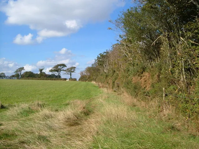
Photo: Derek Harper, CC BY-SA 2.0, via Wikimedia Commons
Biodiversity Net Gain is, in essence, a simple promise: any major development must leave nature measurably better off than it found it, with a ten per cent uplift secured for at least thirty years. Delivering that promise, however, has fallen to a thin layer of ecological consultants, land agents and — crucially — a handful of district council planning officers who now find themselves in the unfamiliar position of monitoring habitat quality decades after a permission is granted.
The regime became mandatory for major developments in February 2024 and was extended to small sites that April. Since then the South West has quietly become the most active market for off-site credits outside the home counties, for reasons both geographic and administrative: a large supply of low-yielding arable land, an established conservation sector, and a run of unitary and district authorities that were already experimenting with green infrastructure before the regulations landed.
The arithmetic of a habitat bank
The metric used to calculate net gain converts habitat into a currency of biodiversity units, weighted by distinctiveness, condition and strategic significance. A developer who cannot fit the required gain on site — most urban schemes cannot — buys units from a habitat bank elsewhere, or from the government's statutory credit scheme as a last resort.
That creates a market with two very different halves. On-site gains are visible, contested at committee and often squeezed into the awkward corners of a site: a strengthened hedgerow, a Sustainable Drainage basin managed for wildlife, a strip of species-rich grassland along a boundary. Off-site gains are where the real habitat creation is supposed to happen — a landowner committing farmland to meadow, woodland or heath for three decades, registered on the national gain site register and backed by a habitat management and monitoring plan.
Reported prices for off-site units in the South West have ranged from a few thousand pounds to well over twenty thousand for high-distinctiveness habitats, with statutory credits priced far higher still. For a farmer on heavy clay in mid-Devon, that is a genuine alternative income. For a developer, it is a line item that can be modelled and, sometimes, shopped around.
Where the credits come from
The geography of supply is revealing. Early habitat banks in the region have clustered on poorer arable land and on former intensification sites — the sort of ground where a change of use costs least in food production and gains most in ecological terms. Devon has seen grassland and orchard proposals; Somerset has seen wetland and wet meadow driven by the levels' hydrology; Dorset has attracted heathland edge and lowland meadow schemes.
The concern raised by ecologists is not that these sites are worthless — many are well chosen — but that the market pushes habitat creation towards the cheapest ground rather than the most ecologically strategic. A credit generated on a plateau field can satisfy a developer building beside the Exe, even though the local nature recovery strategy for that area may prioritise entirely different habitats. Local planning authorities can set a preference for credits sourced within the same national character area, but few have yet written that preference into a firm policy with teeth.
That is the displacement question in its plainest form: is habitat being moved, or is it being added? A defensible answer requires comparing what was lost on site with what is created elsewhere, and judging whether the two are ecologically comparable. Too often, the comparison is made in units rather than in species.
The capacity problem
Local authorities were given new duties without a matching expansion of ecology teams. Several South West planning departments now rely on a single officer, or a shared service across two or three districts, to check biodiversity gain plans, validate the metric calculations and monitor compliance. Condition assessments are meant to follow at intervals across three decades, but the funding mechanism for that oversight remains one of the least settled parts of the system.
There are signs of strain. Objections from parish councils and local wildlife groups have become a regular feature of committee meetings, usually focused on three things: whether the baseline survey was done at the right time of year, whether the thirty-year management plan names a competent and funded body, and whether the off-site credit is genuinely additional or simply a rebadged piece of existing good habitat.
Does the South West have cause for optimism?
Some of it does. The register of gain sites is public and searchable, which is more transparency than most planning obligations have ever enjoyed. The requirement for a named habitat management and monitoring plan, with a responsible body, is a genuine improvement on the vague landscaping conditions of the past. And the sheer volume of schemes has built expertise quickly among regional consultants and land agents.
But the system's credibility will be settled in the field, in years five, ten and twenty-five, when a newt pond silts up or a newly planted hedge is flailed to death by a contractor who has never read the plan. Net gain is not a permission; it is a contract with a long tail.
A practical checklist for tracking a scheme near you
- Find the gain plan. Ask the planning authority for the biodiversity gain plan submitted with the application, not just the ecological impact assessment. The gain plan is where the ten per cent calculation and the off-site arrangements are set out.
- Check the register entry. Any off-site habitat bank must appear on the national biodiversity gain site register. The entry should name the responsible body and summarise the habitat to be created.
- Look at the survey dates. A baseline drawn from a single visit in August or December is weak evidence. Ask when the surveys were done and whether breeding birds, bats and invertebrates were assessed.
- Read the thirty-year plan. Confirm who manages the site, how it is funded, and what happens if the land changes hands. A plan without a funded management mechanism is a wish list.
- Test the distance. Establish how far the credit site is from the development and whether it lies within the same national character area. Large distances weaken the ecological logic, whatever the metric says.
- Ask about additionality. Was the credit site already in favourable management? If so, the gain may be counted twice.
- Note the condition milestones. Good schemes specify monitoring points and a remedy if targets are missed. Ask the authority how it will check them, and who pays.
- Attend the parish level. Parish and town councils increasingly hold the local knowledge that under-resourced planning teams lack. A well-evidenced objection at the right stage carries more weight than a complaint after occupation.
Biodiversity Net Gain is now a permanent feature of the English planning system, and the South West is where its claims will be tested hardest — across coast, culm and moor. The metric is only ever a proxy. The measure that matters is the one nobody can put in a spreadsheet: whether there is more living space in the landscape in 2056 than there was in 2024.